FUN RAFTING und Canyoning
Ihr Wildwasser-Profi im Lechtal / Tirol
... erlebe ein unvergessliches Abenteuer mit unserem professionellen Team. Wir sind dein Spezialist für Outdoor Trendsportarten im Wildwasserbereich und das schon seit 1986.
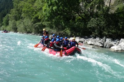
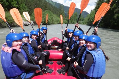
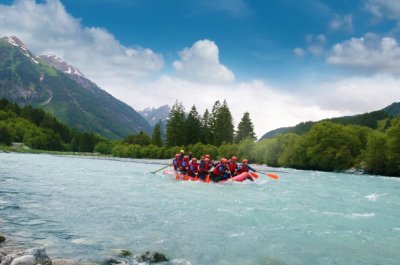
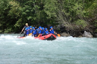
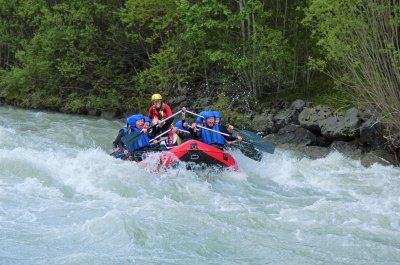
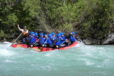
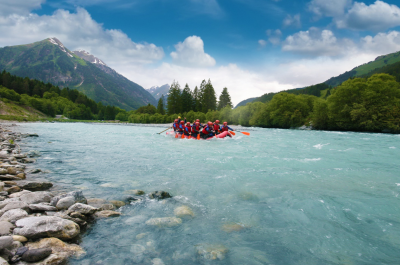
Rafting im Lechtal / Tirol / Österreich

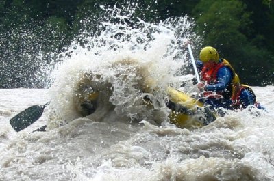
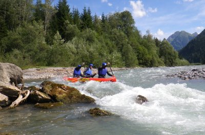
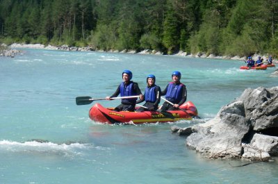
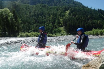
Beim Rafting kannst du die Kraft und Energie des Teamworks erleben. Das Motto: "Den Fluss zusammen erspüren!" Auf dem Lech - dem letzten Wildfluss Europas - bei Wildwasserstufe II fühlen sich Einsteiger, Familien und Naturliebhaber wohl. Auf dem Inn bei Wildwasserstufe III+ sind Sportler und Actionliebhaber richtig. Detaillierte Infos zu unsere beiden Raftingtouren, über Rafting am Lech und Rafting am Inn ...
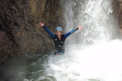
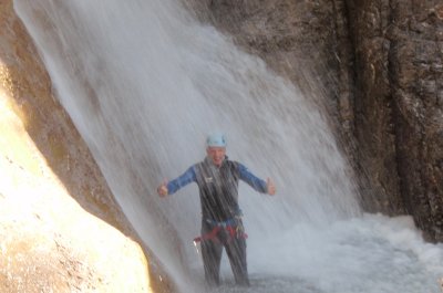
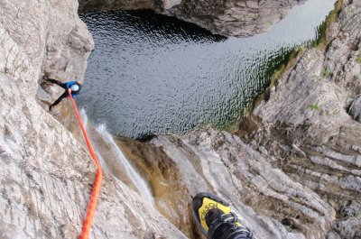
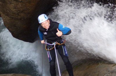
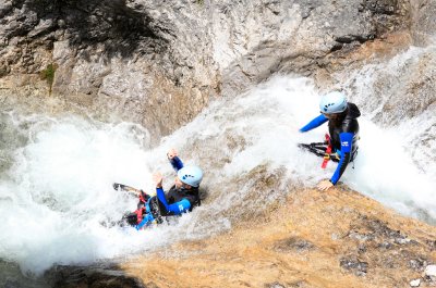
» mehr infoCanyoning im Lechtal / Tirol / Österreich

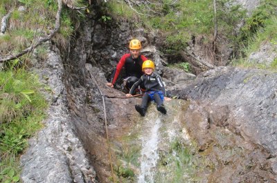
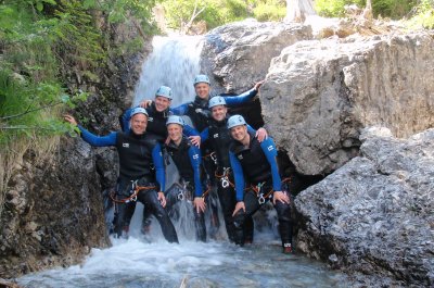
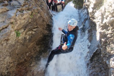
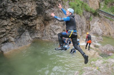
Beim Canyoning erkundest du mit uns die wilden und naturbelassenen Schluchten des Lechtals samt seinen wunderschönen Wasserfällen. Natürliche Barrieren werden durch Rutschen, Springen oder Abseilen gemeistert. Naturgenießer, Abenteurer, Sportler, Adrenalinsuchende... durch die Vielzahl an verschiedenen Touren, bieten wir dir die Möglichkeit das Beste für deine Bedürfnisse zu wählen. Details zu den Canyoningtouren ...
» mehr infoCanadiertouren im Lechtal / Tirol / Österreich

Beim Canadierboot fahren kannst du "Kapitänfeeling" schnuppern! Denn sobald der Wasserstand des Lechs sinkt, ist die beste Zeit, um damit den Naturpark Lechtal zu erkunden. Bei diesen kleinen, wendigen 2-3 Personen Booten ist Abenteuer und Spaß pur angesagt. Je kleiner das Boot, desto größter das Abenteuer!
Unser Programm ...
Vereins- und Firmenausflüge, Incentives, ...

Als Spezialist für Wildwassersport betreuen wir dich mit unserem geschulten Team mit viel Engagement und Herz. Wir organisieren für dich Firmen- und Betriebsausflüge, Abenteuerwochenenden, Erlebnisreisen, Incentives mit Riverrafting und erstellen Kombiangebote. Unsere Outdoorbasis befindet sich im Tiroler Lechtal eingebettet zwischen den Allgäuer und Lechtaler Alpen. Als langjähriger Outdoorveranstalter bieten wir neben Rafting, Canyoning und Canadiertouren auch Wandertouren, Paragleiten, Klettern und Mountainbiken im Lechtal an. Ihr braucht noch einen Tipp zur Unterkunft ... das machen wir!
» mehr infoDu möchtest jetzt mit uns "auf oder ins Wasser"? Dann nichts wie los und lass dir ein tolles Angebot von uns erstellen!
Wir freuen uns, dir ein individuelles Programm und weitere Informationen zukommen zu lassen.
Erlebe unvergessliche Abenteuer und Alpinsport mit den Profis von "FUN RAFTING".
Clemens Friedle mit Team
Dein Spezialist für Outdoor- und Wildwassersport